Battle Relic: United
States Army 1:100 000 scale 1944 map
of area of operations for 101st
Airborne Division during Operation
"Market Garden".
Used during deployment by a veteran of
2nd Battalion of the 506th Parachute
Infantry Regiment (101st Airborne
Division) with provenance.
Introduction: From
Battledetective Wilbert, featured in
numerous previous articles by this
agency, we were given a paper
tactical map on loan, issued to and
used by a World War Two veteran of
the 506th Parachute Infantry
Regiment, 101st Airborne Division,
whose identity will not be disclosed
in this publication but known to
this agency. |
|
(click for
an enlargement)
 |
|
We own a pristine copy of the same
map in question, a US Army 1:100000
scale map of the area around the
Dutch city of 'S HERTOGENBOSCH;
capital of the province of North
Brabant, and were given ample
opportunity to compare it with one
used by a true combat veteran. |
|
(click for
an enlargement) |
|
Item Description: Both
the map owned by this agency and the
one on loan are designated by its
manufacturer as follows: |
|
Holland 1: 100 000 |
For use only
by
War and Navy Department
Agencies Only
Not for sale or distribution |
‘S
HERTOGENBOSCH |
THIRD
EDITION AMS- 1 |
SHEET 5 |
G.S., G.S.
No. 2541
Published by War Office
1913.
3rd Edition 1943. |
Revised and
Reproduced by Ordnance
Survey 1943
ARMY MAP SERVICE U.S. Army
WASHINGTON, D.C. 135431
|
‘S
HERTOGENBOSCH,
HOLLAND
N5130–E500/30x60 |
AUTHORITIES
Partly revised from Dutch
maps of 1936-39
Communications revised from
G.S., G.S. 4138, 4238
Autokart Van Nederland
Intelligence reports up to
1942 |
|
|
(click for an
enlargement)
 |
|
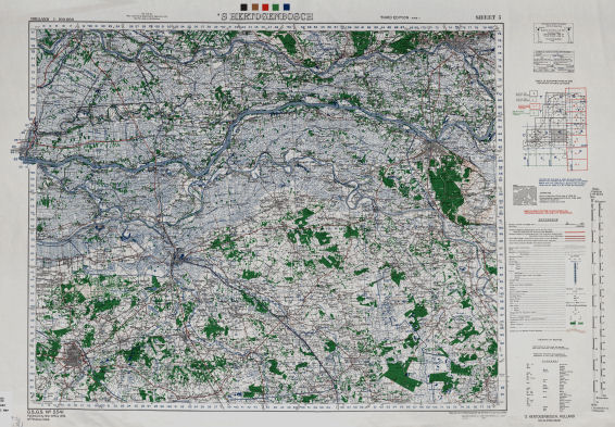
The map Sheet 5 ‘S-HERTOGENBOSCH is
part of a series of 7 maps published
by the Directorate of Military
Survey of the British Army,
reprinted by the US Army Map
Service. |
(click to enlarge)
 |
This map is printed on a 30’ by 60’
inch (65 x 90 centimeters) sheet of
thick paper in color print.
The map shows an area of the Kingdom
of the Netherlands ranging from the
town of VIANEN (province of Utrecht)
in the top left corner to the city
of ARNHEM (province of Gelderland)
in the top right corner and the city
of TILBURG (Province of
North-Brabant) in the lower left
corner to the town of VENRAY
(Province of Limburg) in the lower
right corner.
The copy owned by us is unfolded and
uncut. It still bears its five
(black, yellow, red, green and blue)
print proof color samples in the top
corner.
The veteran’s copy has been cut to
the issue standards and was folded
to the area of operations of the
506th Parachute Infantry Regiment
AND to fit in the pockets on the
type M43 US Army jacket, made
standard to US Army infantry units
as of August 1944. |
|
(click to enlarge)
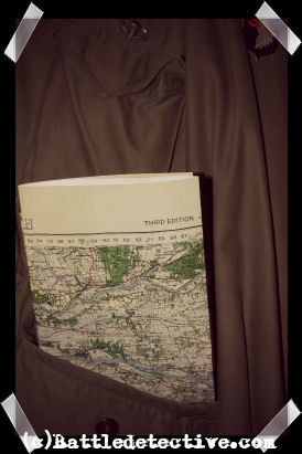
(reenacted photo with
copy of map
and original M43 jacket) |
This map was issued to paratroopers
of the 101st Airborne Airborne
Division in a combat leading role
during Operation “Market Garden”.
Battledetective Wilbert has known
the veteran who was issued this map
since a very young age. He grew up
in the same street as the veteran in the state of New York and
got to know him as his grandfather.
On January 29th 1998, Wilbert was
given the map with an accompanying
note saying:
“Dear Wilbert,
[...]I am sending you the map
that I carried with me when we
parachuted into Holland on September
17th, 1944. The map is folded as I
carried it that day. I landed near
Zon and was at the Wilhelmina Canal
when the Germans blew up the bridge.
The next day, September 18 I was in
Eindhoven, a great day for everyone.
When or if I get to see you at your
home, perhaps I can talk about and
see the places I will never forget.
We spent many weeks on the dike
across the river from Arnhem. The
dirty part of the map at the top is
the way it was folded then." |
|
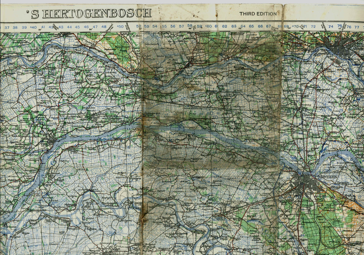
EXHIBITIONS: The
veteran-owned map undoubtedly shows
folds, wear and dirt attached to the
map section in the area where the
506th Parachute Infantry Regiment
was deployed in the later stage of
Operation "Market Garden"; the "Betuwe";
known by the Allied soldiers as "The
Island" because of its locations
between the rivers Rhine, Waal and
Lek. |
|
(click for
an enlargement in Adobe PDF-format)
 |
|
Because of the way the map was
folded, the area of the initial
objectives of the regiment in Son
and Eindhoven was left relatively
unexposed and it is therefore
assumed that the map was used more
extensively on The Island. In this
area of operations the 506th
Parachute Infantry Regiment spent
more time under enemy fire and
sustained more casualties during the
72 day deployment in Holland than in
the first 6 days of Operation
"Market Garden". |
|
|
|
Back to Battlerelics
 |
|
|
