|
File
No.:

Title:
Location of the Battle in
the Teutoburger Forest in 9
A.D.
Investigation made at: Venner
StraŖe 69, 49565 Bramsche,
Germany, Grotenburg 50,
32760 Detmold, Germany,
Varsseveld, the Netherlands
(52į24'27.2"N 8į07'32.7"E,
51į54'42.0"N 8į50'22.2"E
and51į56'53.1"N 6į26'31.1"E)
Period Covered: 9
A.D.
Date: JAN-JUL 2019
Case
Classification:
Location of Historic Events
Status
of Case:
Open Case
|
(click to enlarge)
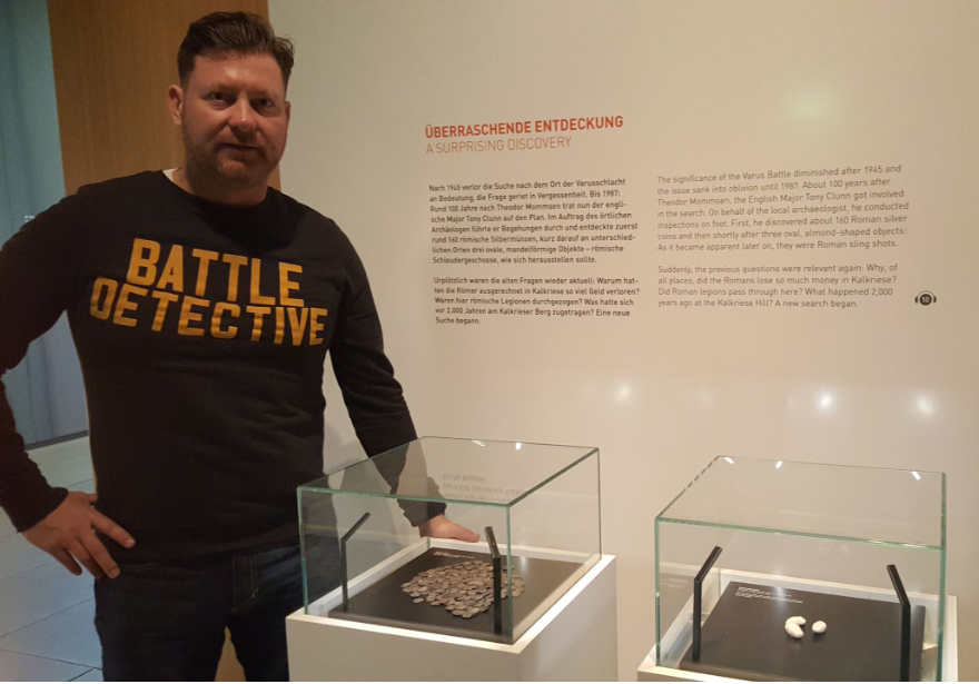
The "Smoking guns" of the
Battle in the Teutoburger Forest:
Roman coins and lead sling shot
projectiles.
|
REASON FOR INVESTIGATION
The Battle of the
Teutoburger Forest took place in
9 A.D. when an alliance of Germanic
tribes ambushed and destroyed
three Roman legions and their
auxiliaries, led by Publius
Quinctilius Varus. The alliance
was led by Arminius, a Germanic
officer of Varus's auxiliary
troops.
For centuries the location of
the battle had been unknown
until at the end of the previous
century archeological
discoveries indicated an area
near the Lower Saxonian town of
Kalkriese as the battlefield.
This agency visited the
battlefield and looked at the
evidence presented to
substantiate the claim of the
site of the Teutoburger Forest
battlefield.
SYNOPSIS: |
|
Location of the Battle in the
Teutoburger Forest
Archaeological investigations
had been taking place at the
Kalkriese Hill in Northern
Germany since 1987.
The area is located between the
edge of the Northern German
uplands and the lowlands.
Approximately 1500 Roman coins
and more than 5000 fragments of
Roman military equipment were
brought to the surface. These
items were widely scattered in
an area of more than 30 square
kilometers between the Kalkriese
Hill and the Great Bog which is
situated approximately 2
kilometers north of the
mountains. The evidence
indicates that Roman troops have
passed this area in Augustan
times. This bottleneck is
passable only on narrow zones at
the foot of the hill, where
settlements of the native
population were constructed on
dry sand, and perhaps at the
southern edge of the bog.
Between these two zones there
was a wet sandy plain.
Systematic excavations started
in 1989 on a field called
ďObereschĒ, where a
concentration of coins and
military objects had been
discovered during field surveys.
Roman military equipment Ėthe
face mask of a Roman helmet was
among the first objects to be
foundĖ and the discovery of an
artificial rampart led to the
conclusion that this must have
been the place of a battle
between Romans and Germans. The
rampart was not part of a
fortified perimeter, but had
been built by the Germans as an
ambush-site to attack Roman
troops whom they must have
expected to pass at this
location. Further sites indicate
that actions did not only take
place at the Oberesch, but at
different locations between the
hill and the bog. It was a
perfect location for a surprise
attack, since it was 70 to 100
kilometers away from the nearest
Roman camps on the Rhine and
Lippe rivers, making it
difficult for other Roman troops
to come to the rescue in the
event of an attack. |
|
(click to
enlarge)
.jpg) .jpg)
The "Kalkriese Mask" and the
sport where it was found outside
the rampart
.jpg) .jpg)
The reconstructed rampart and
the site of recent archeological
discoveries |
|
Silver coins, some gold coins
and a large number of copper
coins, some of them
countermarked by Varus, the head
of the Roman troops in Germany
from 7 to 9 A.D., were found.
They date the event between 7
and 10 A.D.. Varus and his three
Roman legions with the intention
to return to the Rhine area from
a summer camp at the river Weser
in autumn of the year 9 A.D., must
have been coming from the East.
The number of soldiers involved
in the battle is still uncertain
because they had details staying
in the camps along the Rhine and Lippe in order to protect them
and to organize the supply of
the summer camp. It is estimated
that Varus had about 10.000 to
15.000 men on the move. |
The site at the Oberesch proved
to be the most artifact-rich and
significant site within the
research area around Kalkriese.
This is evident from the large
number of finds and the location
of the Oberesch in the center of
the bottleneck between the
mountain and the peat area.
Moreover, it became clear that
the Roman troops, marching from
east to west, had already been
attacked before reaching the
Oberesch. However, no traces of
the battle were found at these
places; it must be assumed that
also forest edges and shrubs,
which are no longer
archaeologically exploitable
today, were used as an ambush.
We are clearly dealing here with
an ambush situation; attacks on
the flank of the passing
legions, which could only try to
move further west. Archeological
evidence suggest the development
of intensive fighting in the
east, with the logistics of the
Roman army still functioning
reasonably well, from fierce
battles at the Oberesch to
escape movements and further
fighting in the west and
northwest.
|
Battlefield forensics
In Kalkriese, only two
arrowheads and three slingshots
were found. In contrast to these
single use weapons most of the
fragments discovered in
Kalkriese are not a result of
fighting but of the subsequent
processes, especially looting
and stripping equipment and
valuables off the dead. One of
the main reasons for the
numerous military remains in
Kalkriese may be that a large
army involved in the fighting
was equipped with many metal
weapons and accompanied by a
large pack train and that the
troops were totally defeated far
away from a region under Roman
control. The Germans started
recycling metal objects on the
battlefield itself. The fact
that the Kalkriese battlefield
is situated in an area away from
Roman control makes it safe to
conclude that the Roman objects
can be attributed to the battle,
not to a Roman settlement. It
would be much more difficult to
get evidence for a battle when
smaller units who did not have
equipment with many metal
artifacts were involved in
contact with an enemy. The
scarcity of Germanic items in
Kalkriese points out another
battlefield fact: victors who
won in their own territory are
often able to care for their
wounded soldiers and to bury
their dead away from the combat
scenes, resulting in their
equipment being removed from the
battlefield as well. |
|
(click to
enlarge)
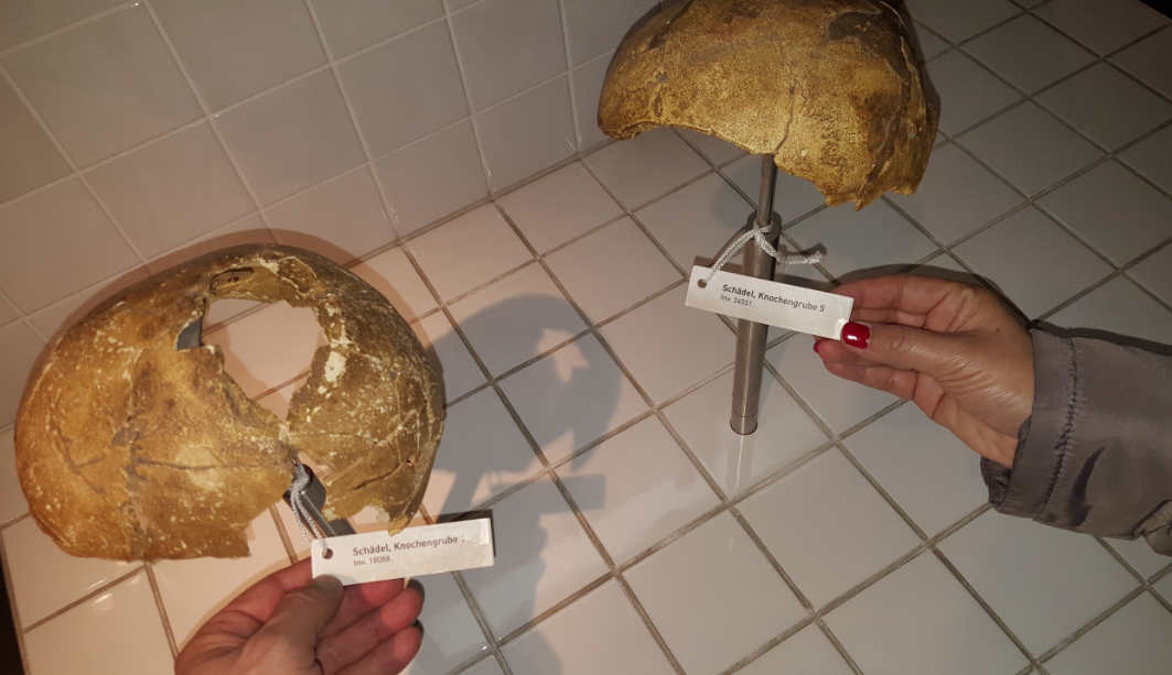
Skulls found in mass grave on
the Kalkriese site |
CONCLUSION
The conclusion may be
drawn that it is less the
action, but the extent of
clearing a battlefield after the
fighting had come to an end that
may explain the difficulty in
finding archaeological evidence
for a military conflict.
- Source: ďWeapons on the
battlefield of KalkrieseĒ by
Achim Rost and Susanne
Wilbers-Rost in Gladius, XXX
(2010), pp. 117-136. ISSN:
0436-029X. doi:
10.3989/gladius.2010.0006 -
|
|
EXHIBITS |
Varusschlacht Museum
On the Oberesch choke point of
the German ambush a modern
museum is built. We visited it
on 1JAN2019.
We were skeptical at first
because of the initial claim
which boils down to: ďWe found
lead sling projectiles and coins
of a low denomination usually
associated with lower ranks in
an army, so this must be the
Varus BattlefieldĒ.
|
|
(click to
enlarge)
.jpg) .jpg) .jpg)
The initial discoveries: lead
sling shot projectiles and Roman
coins |
|
The museum has these items on
display but goes on to
illustrate how more and more
battle artifacts had been found
in the Oberesch kill zone over
the years. Artifacts that
substantiate the earlier clues.
The museum shows with miniature
figures what three Roman legions
on the move must have looked
like, and plots artifacts dug up
after almost 2000 years on
life-sized images of Roman
soldiers, their equipment and
horses. A look-out tower offers
a view of the chokepoint at the
Oberesch field. |
|
(click to
enlarge)
_small.jpg) 1) 1)_small.jpg) 2) 2)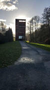 3) 3)_small.jpg) 4) 4)_small.jpg) 5) 5)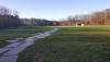 6) 6)
1)
thousands
of miniatures showing what 3
Roman legions looked like
2) Artifacts plotted on a
diagram of Roman military
equipment
3) Museum and viewing tower
4) View from the tower
5) & 6) The ambush
site near the rampart on the
battlefield |
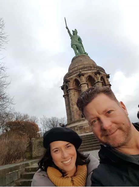
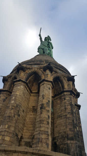
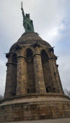
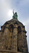
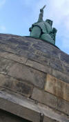
Hermannsdenkmal Monument at
Detmold
We also visited the gigantic
statue in honor of German
warlord Arminius (ďHermannĒ in
German) near Detmold in the
German state of
Nordrhein-Westphalia (GPS
location 51į54'42.0"N
8į50'22.2"E), built between 1838
and 1875. It stands at a
staggering 53 meters (174 ft)
and was designed by Ernst von
Bandel. We climbed inside the
pedestal until we reached the
walkway below the actual statue.
The statue had been built here
without todayís knowledge of the
location of the battlefield but
within the Teutoburger Forest.
|
|
(click to
enlarge)
    |
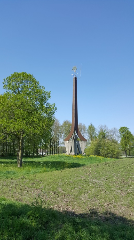
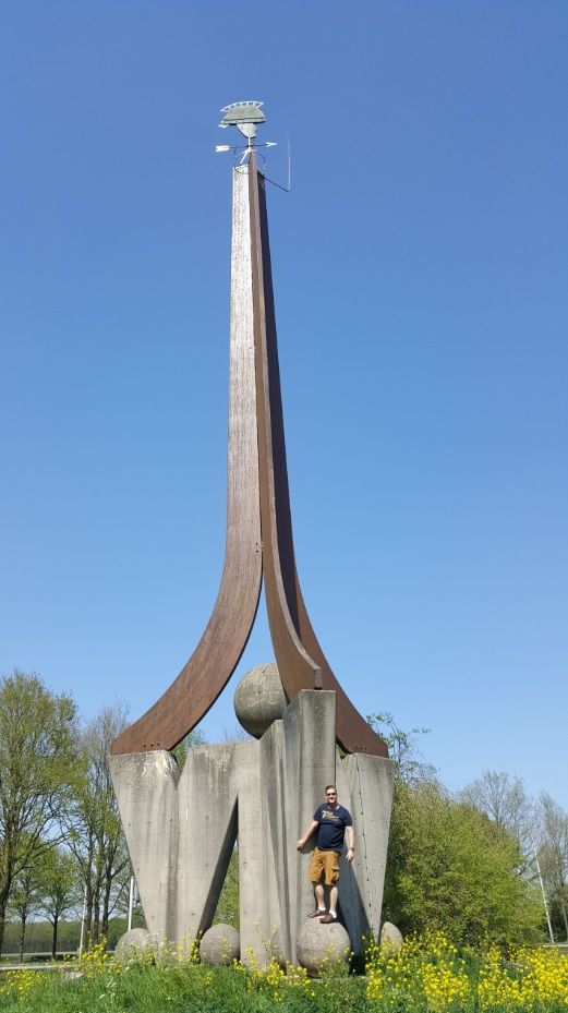
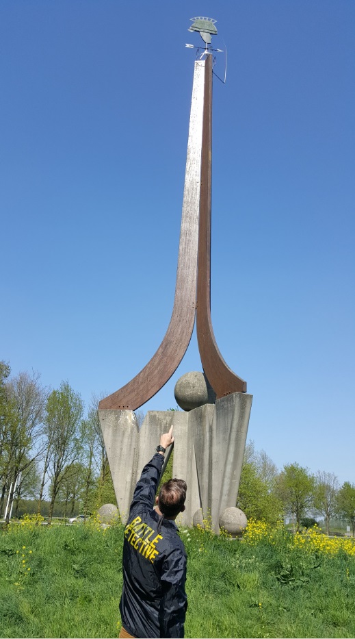
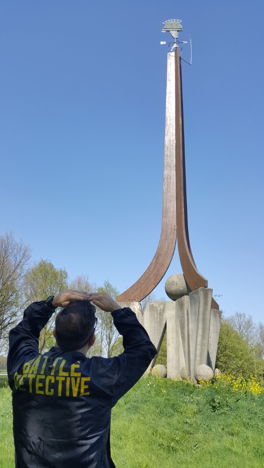
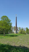
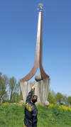
Varsseveld is not ďVarusís
fieldĒ
For some time, local historians
in the Dutch town of Varsseveld
theorized that the etymology of
their townís name referred to
Varusí Field; the battlefield of
Roman general Varus. To draw
tourism, in 1984 the
Varsseveldse IndustiŽle
Vereniging (Industrial Society)
designed and created a 15 meters
(50ft) tall monument with a
large Roman helmet on top which
doubled as a weather vane (GPS
location 51į56'53.1"N
6į26'31.1"E).
The Varsseveld-Varus battlefield
theory has often been ridiculed
in publications.
This is how we found the
monument on 22APR2019:
|
|
(click to
enlarge)
    |
|
Back to Battle Studies
 |
| |


.jpg)
.jpg)